
All About LiDAR
Summary: LiDAR sends out pulses of light, which bounce off of various surfaces. The equipment measures how long it took for the light to bounce back, and then calculates how far away that surface was. It's handy for mapping out construction sites.
LiDAR stands for Light Detection and Ranging. Some people extend the acronym to mean Light Detection and Ranging or Laser Imaging, but if you're being literal, that would be closer to LiDAROLI, which sounds like a meaty pasta.
Anyway, LiDAR uses light to measure things. It sends out light, and then measures what bounces back into its sensors. It's not like a photo that shoots once though. It fires off hundreds of thousands of light bursts per second and then reads the data that it receives.
Inside a LiDAR unit there is:
- A laser (usually near-infrared, which is invisible to humans)
- A sensor to receive reflected light
- Precision timing electronics
- Optionally, an inertial measurement unit (IMU) and GNSS receiver to track every measurement's location
- Light Pulses
The laser fires short pulses, only nanoseconds apart. Some construction-grade systems can emit hundreds of thousands to over a million pulses per second. - Reflect and Receive
The light hits various surfaces and reflects back. Modern systems often record multiple returns from a single pulse. This helps paint a more accurate 3D model. - Timing Calculation
The program uses the simple formula: Distance = (speed of light × time of flight) / 2. Cheap systems won't have the same timing accuracy as the high-end ones. This produces discrepancies in measurements. - Positioning and Direction
On a drone, mapping vehicle, or tripod, the system continuously tracks its own location (GNSS) and attitude (IMU). Attitude is the direction it's pointing. This makes it easier to create a map from the points the system measures. It can attach real coordinates to each point of information. - Point Cloud
All of those points, along with their coordinates, are arranged as a detailed 3D map. The software has to use millions of individual points. It even has to consider the intensity of the returned point. These maps are colorless, but attaching a standard camera next to the LiDAR emmiter allows color data to be collected with each point. - Deliverables
The map data can be used by contractors to make digital terrain models (DTMs), digital surface models (DSMs), contours, volumetric calculations, cross-sections, clash detection models, and progress comparisons. Sometimes this requires a little cleanup of the data first, as little abberations (like a dragonfly or a blowing leaf) can cause interference.
When the infrared laser burst begins, the beam reaches a surface. That surface could be ground, rebar, structural steel, plants and trees, etc. That beam then reflects to varying degrees, depending on how absorptive the surface is. The system then measures the time it took for the light to travel out and back. That's why it needs precise timing components.
Using the known measurement for the speed of light on Earth, that number can be used to calculate distance very accurately. Now the system can consider the direction the laser was pointed and the sensor’s position and orientation in order to get a 3D coordinate. It does this over and over, and eventually creates a "point cloud," consisting of all those measured points. Put together, it makes a 3D map that can be viewed from any angle.
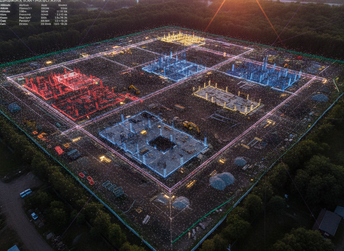
LiDAR scan of a construction site
A Breakdown of the ProcessTypes of LiDAR
Aerial LiDAR — Drones are used to get quick coverage of big work sites, earthwork, stockpiles, etc. They are excellent for topographic surveys, as they can get a top-down angle to measure the site in a very short period.
Ground-based (tripod) LiDAR — This has the highest detail and accuracy for structural verification, façade work, and interiors.
Mobile LiDAR - These can be vehicle mounted or backpack-mounted. They are efficient for long linear projects (roads, utilities, rail) or large campus-style sites.
Practical Limitations Contractors Should Know
LiDAR is powerful, but not flawless. There are a lot of factors that can affect accuracy, like sensor quality, GNSS/IMU quality, the operator's competence, and data processing. Highly reflective surfaces like water can created skewed return data. Very dark materials can absorb too much light and reduce how much light arrives back at the sensors. Plants and weather can also blocks some ground points. After the data is collected, you still need trained professionals to process it. That requires pricey software and a long learning curve.